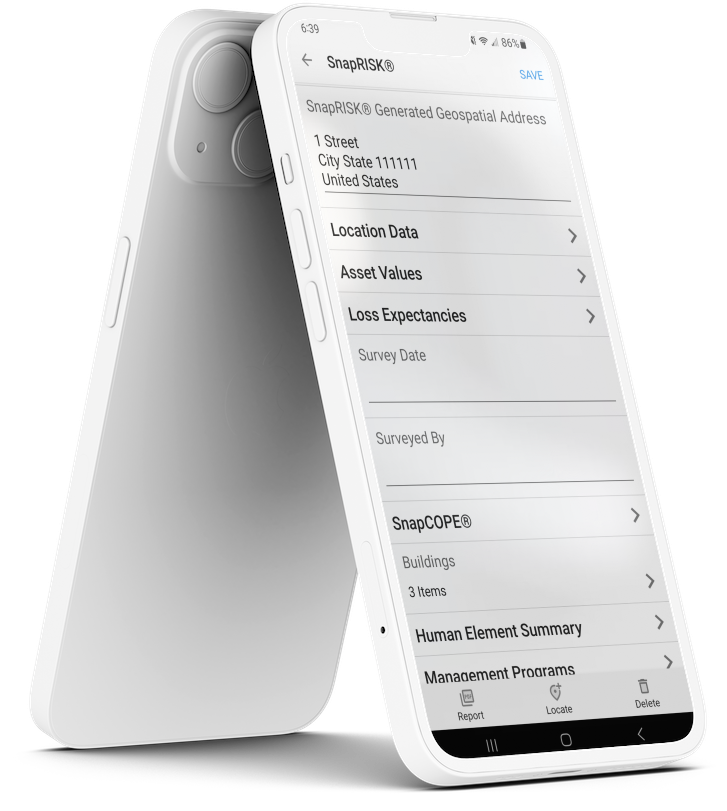
Technology That Works for You
SnapRISK’s suite of purpose-built apps was designed to simplify and strengthen every step of the risk management process. From real-time data capture and mobile-enabled surveys to instant alerts and dynamic risk mapping, our technology works seamlessly for you—delivering the insights you need, when and where you need them. Whether on-site or remote, our tools empower smarter decisions and more efficient outcomes.
Each app can be tailored to your specific needs. Scroll down or click an app icon to learn more.





SnapCAT®
Get protected from the elements
From hurricanes to earthquakes, from flood to fire, collect vital data to help defend your properties from natural disasters.
Clients needing SnapCAT® have...
Large, diverse property portfolios across multiple regions
Exposure to hurricanes, floods, earthquakes, wildfires, and other severe hazards
Inconsistent, outdated, or incomplete NatCat data across sites

NatCAT Hazard reports in a Snap!
Flood, wind, quake, fire, hail, and hurricane data is automatically gathered for each location so you can generate a hazard report at the click of a button.
Learn more about SnapCAT®
SnapCOPE®
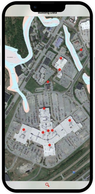
COPE data ready for visualization
Making it easy to collect all your Construction, Occupancy, Protection, and Exposure data.
Clients needing SnapCOPE® have...
Any occupancy, simple or complex.
An interest in having access to COPE information through an app and having all building data tied to geospatial pin.

SnapCOPE is designed to be flexible for any industry
Manufacturing, Industrial, Retail, Hospitality, Government, Healthcare, Facility Management, and much more!
Learn more about SnapCOPE®
SnapREC®
Easily manage recs
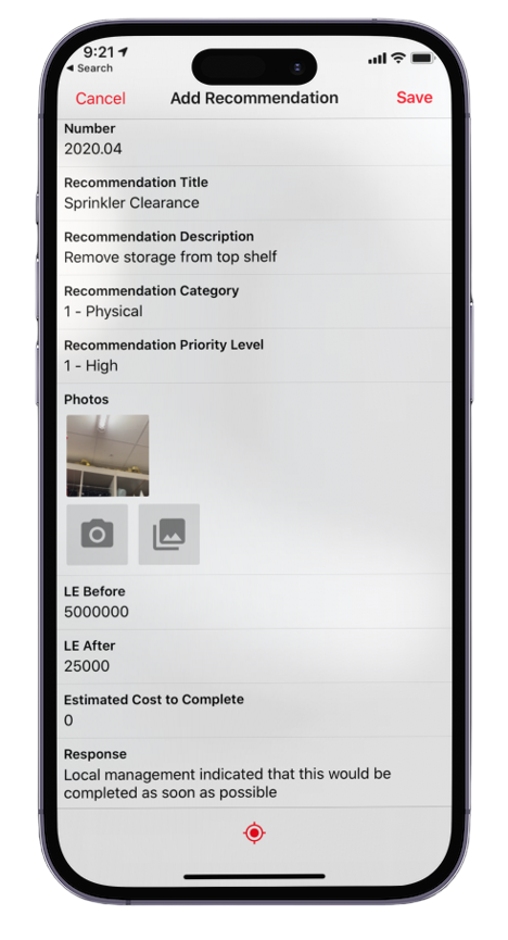
Facilitate risk control surveys and improve risk interactively. Recommendations are documented, categorized, prioritized, and completed quickly and efficiently.
SnapREC® allows you to...
Facilitate property risk control surveys by using only your smart phone to make recs
Deliver recommendation reports by email or text within minutes of completing the survey
Include photos or video, make notes by voice recognition, and pin recommendations to specific buildings by GPS coordinates. construction characteristics

Analyze Your Recs
Your recommendations are available to you at anytime. Our analytical tools offer your further insights.
Learn more about SnapREC®
Self E-AUDIT®
Perform self audits
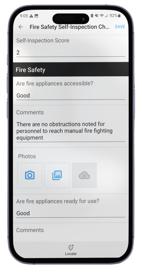
SnapRISK can customize your app and train your staff to collect the exact data that you need.
Self E-AUDIT® allows you to...
Put the power of SnapRISK® in the hands of your team with a customized audit, including pictures and video
Produce reports immediately and correct deficiencies more quickly.
Customizable templates: Tailored to your industry, risk profile and your needs.

Revolutionize how you assess and manage property risk
Digitally, efficiently, and intelligently - without waiting for a site visit.
Learn more about Self E-AUDIT®
SnapALERT®
Realtime natural hazard and weather alerts
SnapALERT® is a geospatial-based weather alerting system, providing proactive, live, and reactive email alerts to your whole team. The email alerts are fully integrated with a web dashboard.
SnapALERT® allows you to...
Discover which locations in your portfolio are at risk from extreme weather events
Create data exports and reports from a live dashboard
Geospatially analyze weather risk up to 72 hours in advance with live data feeds and map overlays

Only the alerts that are important to you
Customize your experience to only be alerted by events that you care about. Thunderstorms, hurricanes, flooding, tornadoes, and much more!
Learn more about SnapALERT®
SnapVALUES™
Simplify values collection and eliminate spreadsheets
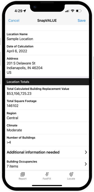
SnapVALUES™ delivers fast, accurate replacement cost estimates – empowering better insurance decisions and reducing underinsurance risk. Our mobile technology eliminates spreadsheets and makes values collection infinitely easier, more accurate and defensible.
SnapVALUES™ allows you to...
Eliminates cumbersome, time-consuming methods of collecting values
Memorializes the data and provides real-time year over year analysis
Automatically identifies discrepancies, significant changes and outliers

SnapVALUES is easily integrated with other internal or external systems
Customize your experience to have your own threshold for variances and automated tracking to make sure local teams complete the required task.
Learn more about SnapValues®
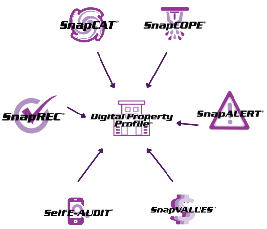
Digital Property Profile®
Create your Digital Property Profile
One of the distinct ways SnapRISK stands apart from traditional property engineering firms is through our proprietary Digital Property Profile® (DPP)—a dynamic, data-rich view of your property’s risk, accessible 24/7 by both clients and brokers through our secure app.
This always-on, digital-first solution empowers users with real-time insights, structured risk data, and instant access to the most current property intelligence—no waiting, no guesswork.
The Result?
Data rich underwriting market reports
Reduced manual effort
Stronger insurance outcomes
A measurable return on investment
Our Digital Property Profile® turns property data into smart, actionable intelligence—anytime, anywhere.
No matter your needs, we've got you covered
The SnapRISK suite of apps were created by industry veterans who recognized the need for a smarter, faster, and more effective way to manage property risk. Built from firsthand experience in the field, our technology is designed to solve the pain-points risk managers, brokers, and insurers face every day—from time-consuming data collection to fragmented reporting systems.
- Verify Visually
- Allows visual verification photo fields (date, time, location stamped) to confirm data collected.
- Offline Operability
- Works in a disconnected environment with any iOS or Android device.
- GIS Enabled
- Provides Geographic Information System Mapping to ensure buildings are located correctly.
- One-tap Reports
- Alleviates time spent copying/pasting pictures and transferring hand-written notes into a report template.
- Data Standardization
- Standardizes your data for easy future analysis instead of messy spreadsheets.
- Interactive Dashboards
- Get a macro look at your data in a live dashboard environment.
- Realtime Data Syncs
- Improve team collaboration with live syncing data.
- Countless Export Formats
- SnapRISK supports dozens of data export types.
